Local Knowledge · Beaches
Nine coastal spots.
Nine different days out.
From the easy walk to Crooklets to the wilder cliffs of Sandymouth and the broad sweep of Widemouth, this is our practical guide to choosing the right beach around Bude.
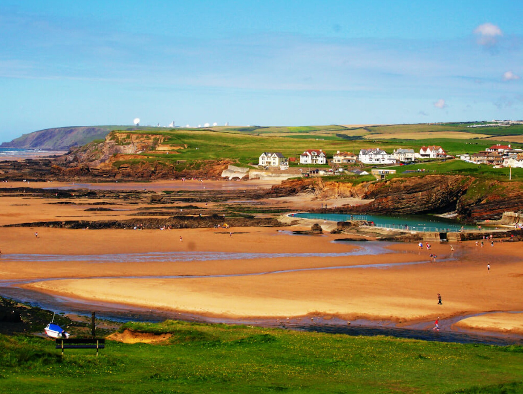
The easy, everyday beach from BSS.
Crooklets
Crooklets is the closest beach to Bude Surf Shack — about a five-minute walk — and the natural first choice for an uncomplicated beach morning, a quick surf check or sunset on the sand.
- Best for
- Surfing, family beach days, rock pools and popping back to the house.
- Good to know
- At lower tide the sand opens out and links towards Summerleaze. At high tide there is much less beach, so check the tide before settling in. Lifeguard cover and dog restrictions are seasonal: follow the signs on the day.
- Local tip
- Walk down rather than drive. From BSS it is often quicker than finding a space, and you can easily return for lunch or forgotten towels.
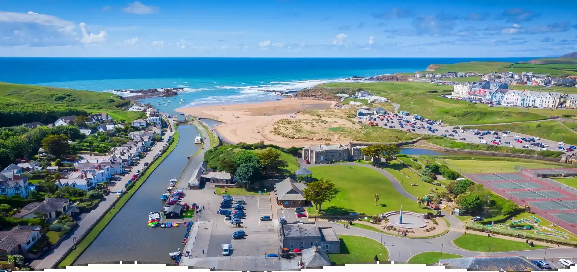
Bude’s classic all-round beach.
Summerleaze
Summerleaze combines a broad sandy beach with the harbour, dunes and Bude Sea Pool. It is around twelve minutes on foot from BSS and works especially well when a group wants swimming, sand and cafés in one place.
- Best for
- Families, sea-pool swimming, beginner beach days and easy access to town.
- Good to know
- The sea pool offers a more sheltered swim, but it is still a tidal outdoor pool with cold water and no guarantee of lifeguard supervision. Dogs may be subject to seasonal lead rules, so check current signs.
- Local tip
- Use the canal or harbour for a gentler walk home, or continue over the headland to Crooklets for a simple two-beach circuit.
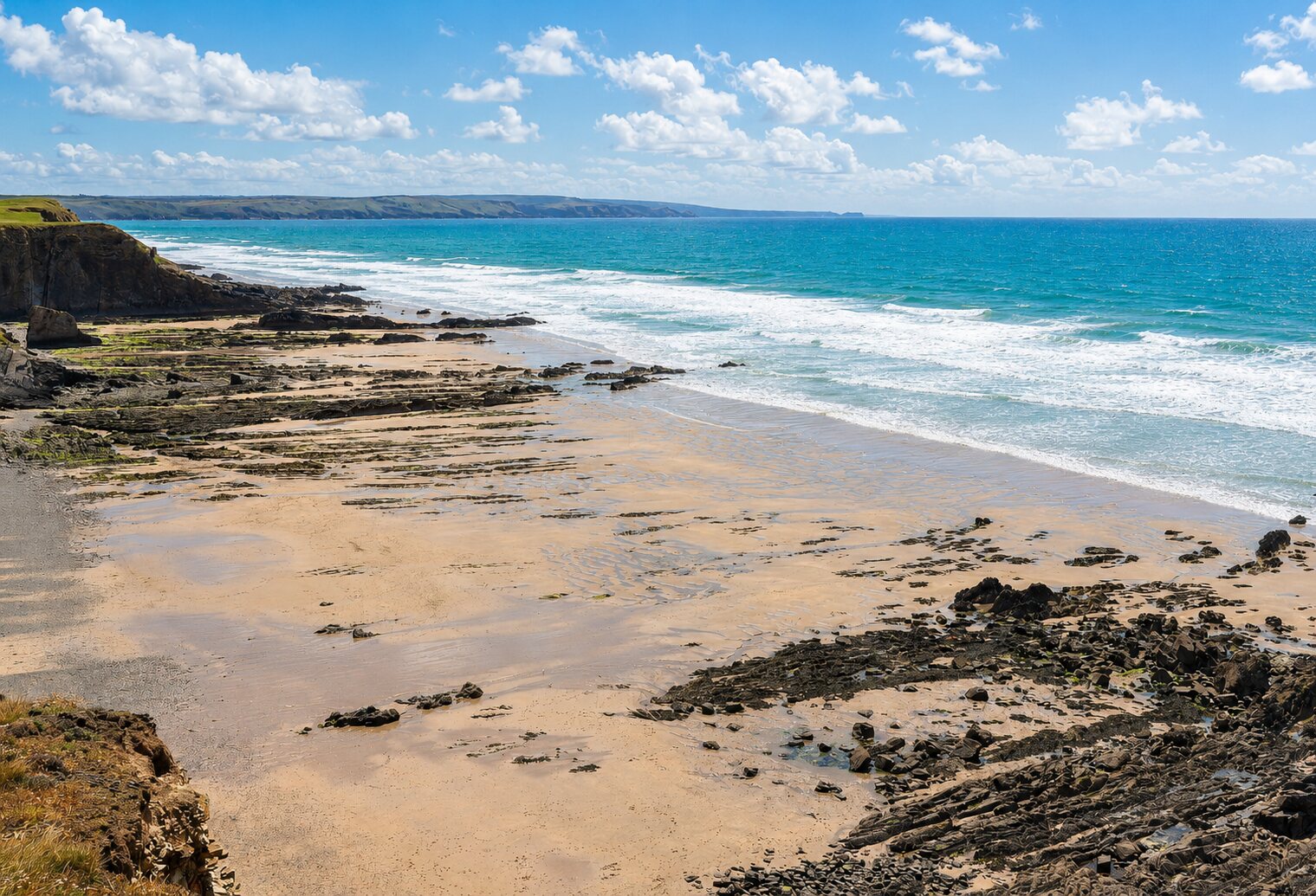
A quieter cove reached by the coast path.
Northcott Mouth
Northcott Mouth sits north of Crooklets beneath the cliffs and feels noticeably wilder. The best approach from BSS is on foot via Crooklets and Maer Down, following the signed South West Coast Path.
- Best for
- Coastal walks, space, rock pooling and a quieter beach day.
- Good to know
- Access, sand and rock formations change dramatically with the tide. The cliffs can be unstable and the sea can cut off sections of beach, so stay away from cliff bases and do not rely on walking back along the sand.
- Local tip
- Make the walk part of the day. Take water, wear proper shoes and return on the coast path if the tide is rising.
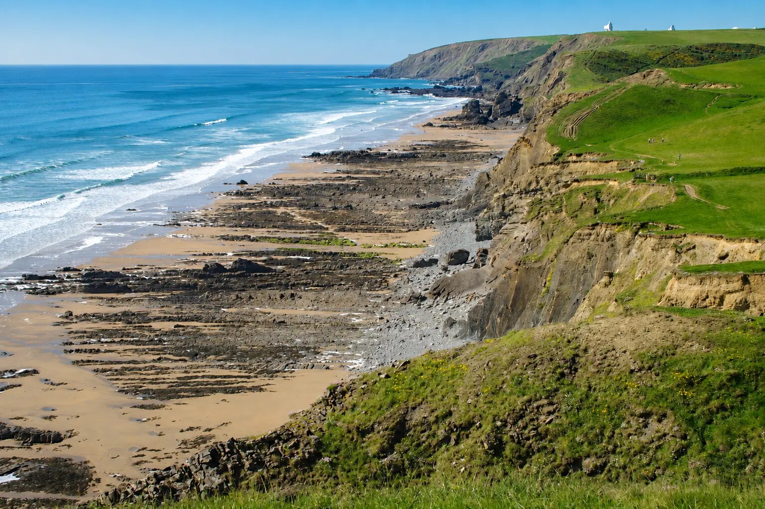
Big cliffs, waterfalls and a properly wild horizon.
Sandymouth
Sandymouth is one of the most dramatic beaches north of Bude, with tall folded cliffs, rock formations and seasonal waterfalls. It is a rewarding coast-path destination or a short drive for a longer day out.
- Best for
- Scenery, long walks, photography, rock pools and open space.
- Good to know
- The beach is transformed by the tide and can become cut off in places. Cliff falls are a real risk: keep well clear of the cliff face and check tide times before exploring beyond the main access.
- Local tip
- Arrive near lower tide to see more of the beach, but leave generous time to return. The coast-path walk back towards Bude gives the best elevated views.
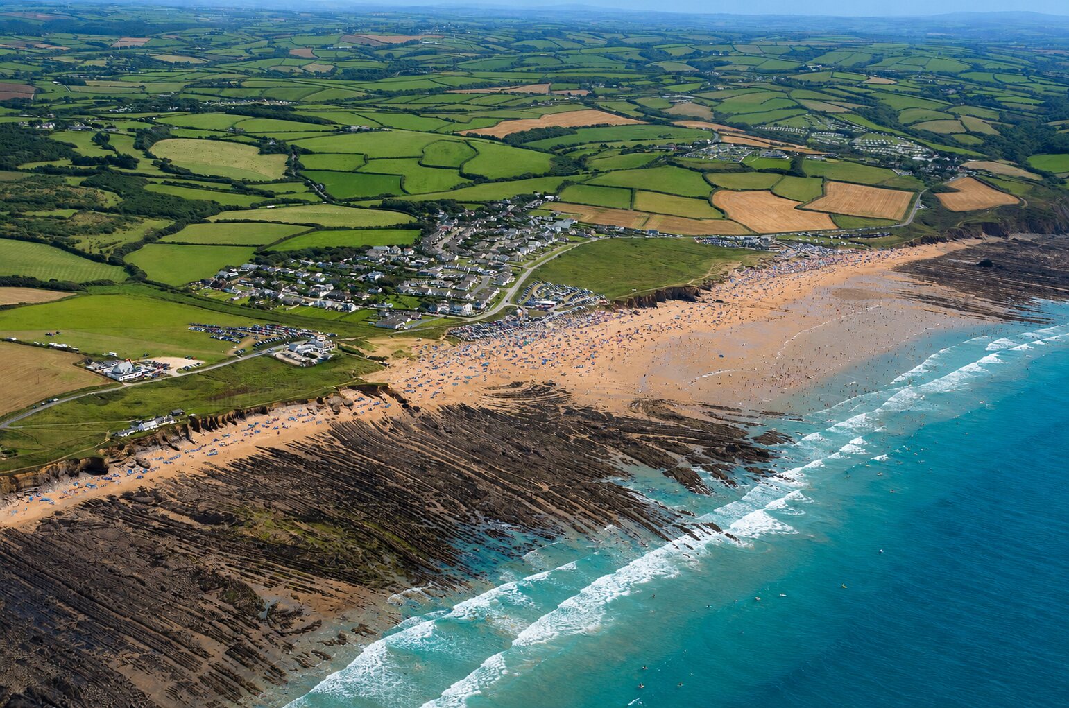
The broad surf beach south of Bude.
Widemouth Bay
Widemouth is a long, open bay a few miles south of town, popular with surfers and families because there is room to spread out and several places to access the sand.
- Best for
- Surfing, surf lessons, long beach walks and full-day beach trips.
- Good to know
- It is an exposed Atlantic beach with strong currents and changing sandbanks. Swim or surf between the flags when lifeguards are present, and choose a lesson with a local surf school if you are new to the conditions.
- Local tip
- For a memorable arrival, walk south from BSS on the South West Coast Path past Compass Point and Upton. Arrange a lift or bus back if the return walk feels too much.
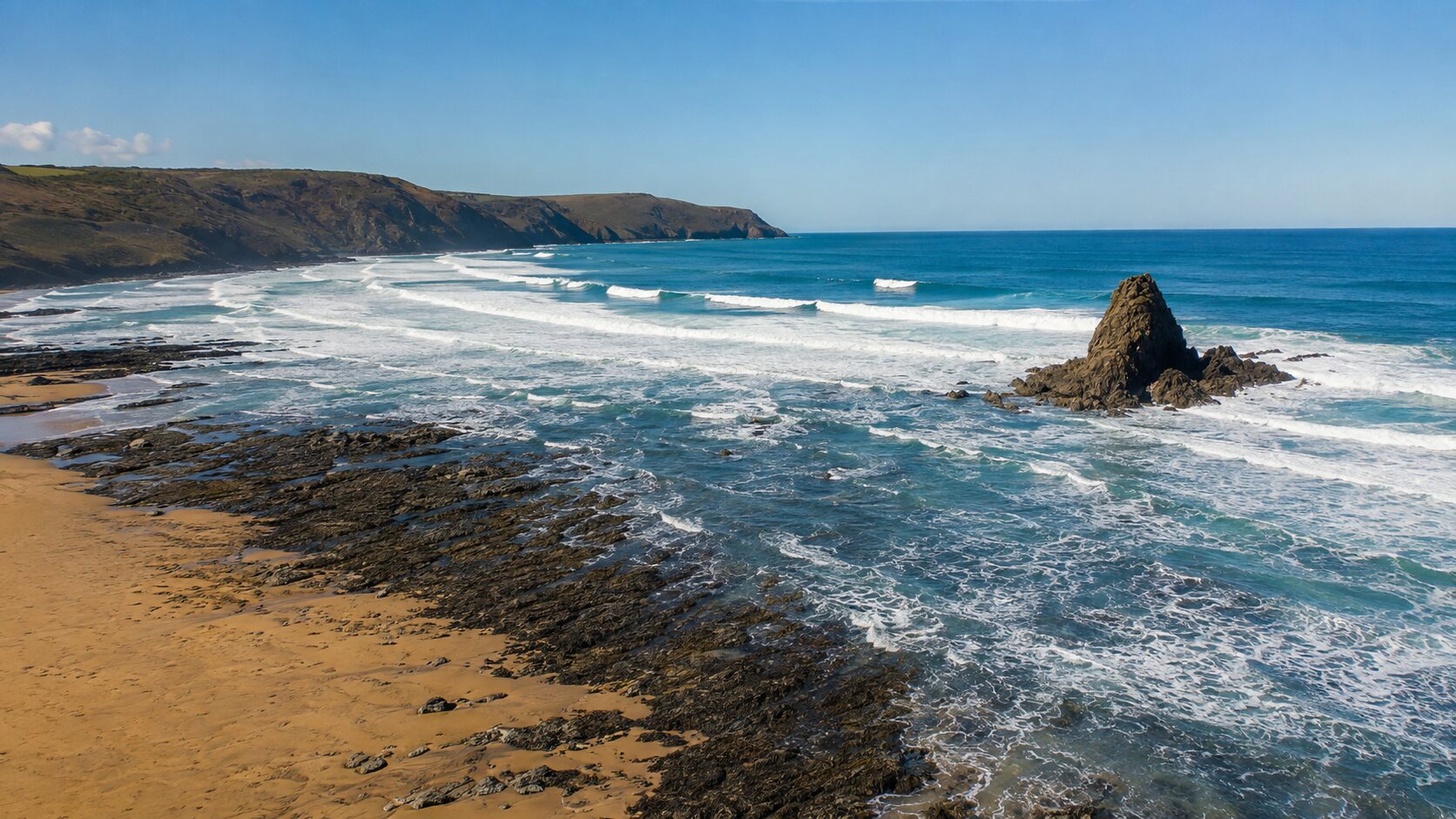
The quieter southern end of Widemouth.
Black Rock
Black Rock is the southern end of Widemouth Bay, named for the dark rock formation just offshore. It usually feels more spacious than the central part of Widemouth and has a rugged, open character.
- Best for
- Long walks, sunsets, experienced surfing and escaping the busier access points.
- Good to know
- The beach is exposed and the rocks, currents and shore break demand care. Conditions can differ from the main bay, and facilities and lifeguard cover may be more limited.
- Local tip
- Walk the full sweep of Widemouth at lower tide, keeping an eye on the waterline and using established access points rather than climbing over rocks or cliffs.

A remote pebble-and-sand cove in a deep valley.
Duckpool
Duckpool lies north of Sandymouth where the wooded Coombe Valley reaches the sea. It feels far removed from town, with a stream, a high shingle bank and steep green headlands framing the bay.
- Best for
- Wild scenery, picnics, coast-path walks and a quieter escape.
- Good to know
- The beach is exposed, the shore can be steep and conditions change quickly. There is no dependable lifeguard cover, so treat it as a place for exploring rather than an easy swimming beach. Use the established paths and keep clear of cliff edges.
- Local tip
- Combine Duckpool with the signed South West Coast Path rather than trying to cover too much beach at the waterline. The valley can be muddy after rain, so boots are useful.
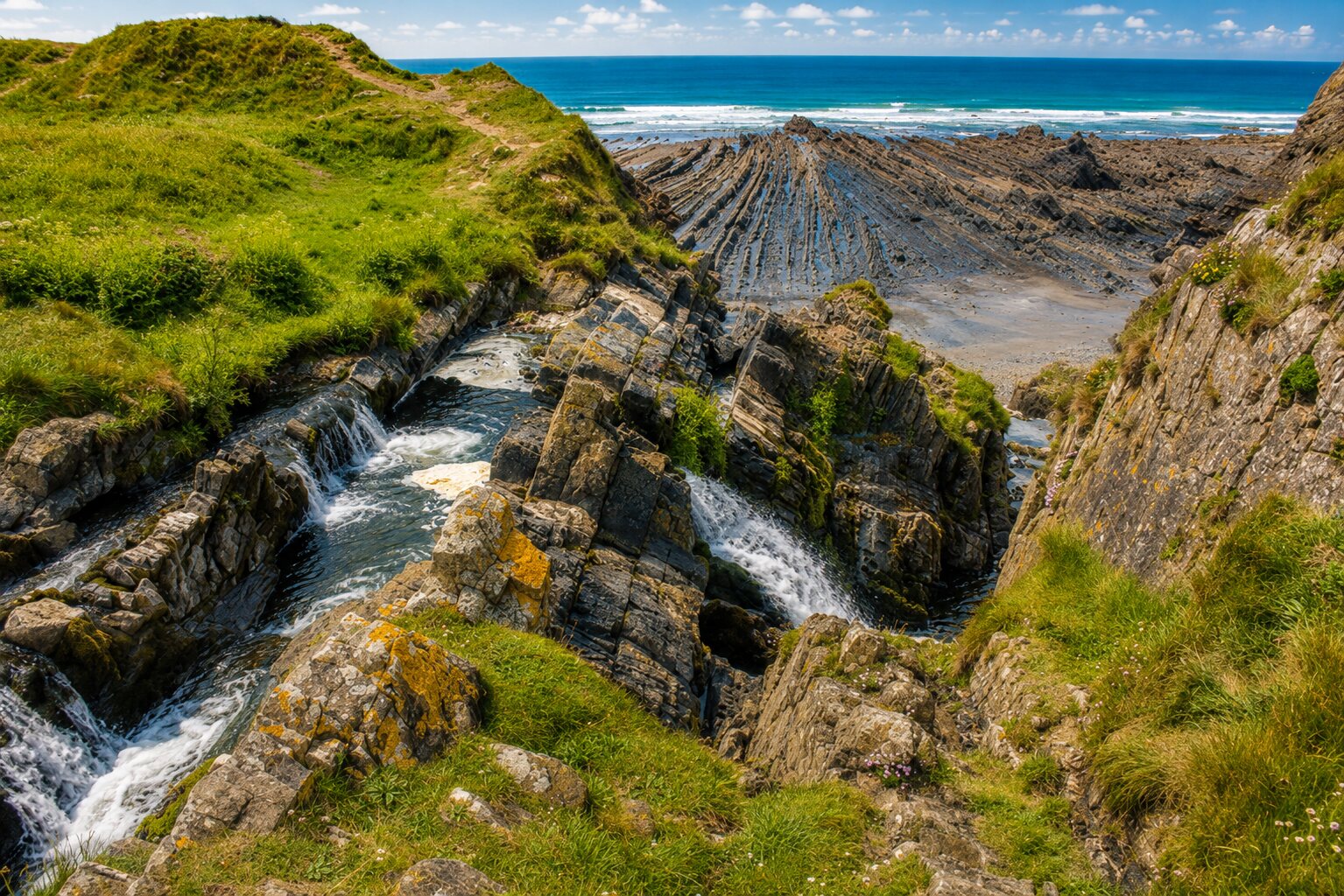
A waterfall dropping onto a remote Atlantic beach.
Welcombe Mouth Waterfall
Farther north beyond Duckpool, Welcombe Mouth is a wonderfully isolated rocky beach where a stream tumbles over the cliff onto the shore. It is the waterfall beach to seek out when you want a genuinely wild coastal excursion.
- Best for
- Waterfall views, photography, geology and adventurous coastal walks.
- Good to know
- This is a remote, uneven and tide-dependent place with limited facilities. The access track and beach can be rough, slippery or muddy, and the cascade is most impressive after rain. Do not stand beneath unstable cliffs or attempt the shore at a rising tide.
- Local tip
- Treat it as a dedicated outing rather than an add-on to a casual beach day. Check the route and tide first, wear sturdy footwear and allow more daylight than you think you need.
A poet’s refuge tucked into the Morwenstow cliffs.
Hawker’s Hut
Hawker’s Hut is a tiny timber shelter set into the cliff above the Atlantic near Morwenstow. It was built in the 1840s by the Reverend Robert Stephen Hawker, the famously unconventional vicar of Morwenstow. Hawker used driftwood and timbers recovered from shipwrecks below the cliffs, giving the hut an inseparable connection to this dangerous stretch of coast. He came here to write poetry, reflect and watch the sea, and visitors during his lifetime included fellow writers such as Alfred Tennyson. Hawker was also known for caring for shipwrecked sailors and arranging Christian burials for bodies washed ashore. His best-known work is “The Song of the Western Men”, often called “Trelawny”, and he helped establish the modern church harvest festival at Morwenstow in 1843. The Grade II-listed hut is now cared for by the National Trust and is the smallest building in its care. Reached on foot from the South West Coast Path, it remains a wonderfully atmospheric window into Hawker’s life and the history of Cornwall’s wrecking coast.
- Best for
- Literary history, dramatic sea views, a short clifftop walk and an atmospheric detour from Morwenstow.
- Good to know
- The hut sits below the main coast path and is reached by steep, uneven steps close to an exposed cliff edge. Wear suitable footwear, supervise children closely and avoid the descent in strong winds or poor visibility.
- Local tip
- Start near Rectory Farm and St Morwenna’s Church, then follow the National Trust’s signed Hawker’s Hut walk. Allow time to see the churchyard memorials and the cliff views rather than treating the hut as a quick roadside stop.